Drone LiDAR scanners and SLAM scanners: models, comparison and prices
This category lists the LiDAR laser scanners that DroneBase integrates and supports for professional 3D surveying: aerial payloads for drones (GS-100C+, GS-130X, GS-260H, GS-260X), the handheld SLAM GS-100G Series and the GoSLAM X1 drone SLAM scanner for confined spaces. Below you will find a spec comparison, selection criteria and the factors that drive the price of a drone LiDAR scanner and of a complete survey kit.
LiDAR laser scanners: what they are and how they work on drones and handheld
A LiDAR laser scanner emits laser pulses and measures how long they take to return: each return becomes a point with X, Y, Z coordinates. Hundreds of thousands of measurements per second build the point cloud, the starting point for 3D models, DTMs, cross-sections and volume calculations.
For the points to be correct, the scanner's position must be known at every instant. On drone LiDAR scanners this is the job of the POS, a multi-constellation GNSS receiver plus IMU (for example gSpin 210 or gSpin 310 at 200 Hz on the GS series), with RTK or PPK corrections. SLAM scanners reconstruct their position from the geometry of the environment, which is why they also work indoors and without satellite signal.
Multi-echo sensors (dual or triple return) record several returns per pulse, which is what allows the ground to be captured beneath vegetation as well as the canopy.
Drone, handheld and SLAM LiDAR scanners: model comparison
Key specifications as stated on the product pages of the models in this category. Real-world performance depends on flight altitude, surface reflectivity and POS configuration.
| Model | Type / platform | Points per second | Range | Returns | Weight | Camera |
|---|---|---|---|---|---|---|
| GS-100C+ | Aerial: DJI Matrice 300/350 RTK, multirotors and VTOL | 720,000 | up to 450 m (optimal conditions) | Triple echo | approx. 1 kg | 26 MP RGB |
| GS-130X | Aerial: DJI Matrice 300 RTK / 350 RTK (SkyPort 2.0) | 1,280,000 | 120 m | Dual echo | approx. 1.6 kg | 26 MP RGB (optional) |
| GS-260H | Aerial: drones and light vehicles | 1,920,000 | 300 m | Triple echo | 1.1 kg | 26 MP RGB |
| GS-260X | Multi-platform: drone (multirotor, VTOL), vehicle, rail, handheld | 1,920,000 | 300 m | Triple return | 1.1 kg | 26 MP RGB |
| SLAM GS-100G Series | Handheld SLAM (Pure SLAM, RTK-SLAM, PPK-SLAM) | 320,000 | 120 m | Dual pulse | not stated | 3 × 5 MP panoramic cameras |
| GoSLAM X1 5G | Drone SLAM on DJI Matrice 4E/4T, in a collision cage, no GPS needed | 200,000 | 40 m (10% refl.) – 70 m (80% refl.) | not stated | not stated | 5 MP global shutter |
How to choose: aerial survey, handheld SLAM or indoor
- Aerial survey of large areas (topography, quarries, infrastructure corridors, power lines): a drone LiDAR payload. The GS-100C+ is the entry choice; GS-130X, GS-260H and GS-260X increase point density and range.
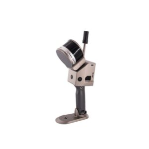
- Ground-based, buildings and GNSS-denied areas (interiors, roof spaces, historic centres, construction sites): a handheld laser scanner such as the SLAM GS-100G Series.
- Confined spaces by drone (tunnels, tanks, underground structures): GoSLAM X1, a SLAM scanner in a collision cage for DJI Matrice 4E/4T that needs no GPS.
- One sensor on several platforms: the GS-260X is specified for drone, vehicle, rail and handheld use.
The drones already in your fleet, the deliverables your client expects and the software your team already uses also weigh on the choice.
Drone LiDAR scanner price: what drives it
The price of the scanner is not the same as the cost of an operational survey kit. The main cost items are:
- LiDAR sensor: number of channels, points per second, number of returns and range. This is what separates a GS-100C+ from a GS-260X.
- POS / IMU and GNSS: IMU grade, update rate and RTK/PPK support determine the absolute accuracy of the point cloud.
- Drone platform: aerial payloads require a compatible aircraft (for example DJI Matrice 300/350 RTK, or Matrice 4E/4T for the GoSLAM X1). If you are starting from scratch, see the 3D LiDAR combos.
- Processing software: trajectory, georeferencing, colourisation, classification and deliverable extraction. Some models include the licence, others require it separately.
- Training and commissioning: flight planning, calibration, data processing and quality control.
Laser scanner list prices
List prices as published on the product pages, including 22% VAT. The product page and our quote are binding.
- GoSLAM X1 5G: from €7,185.80 (SLAM scanner kit)
- GS-100C+: €8,799
- SLAM GS-100G Series: from €10,980 (GS-100G); GS-120G €17,690; GS-130G €27,900
- GS-130X: €17,099
- GS-260H: €17,699
- GS-260X: €27,899
What you get: point cloud, DTM, cross-sections
- Point cloud, georeferenced and colourised with the RGB camera, exported in the formats listed on each product page (for example LAS for the GS-100C+).
- DTM and DSM: terrain and surface models, contour lines, morphological analysis. Multi-echo helps reconstruct the ground under vegetation.
- Cross-sections and profiles for road, rail and hydraulic design and for slope monitoring.
- Volume calculations for quarries, stockpiles and excavations.
- 3D models for CAD and BIM workflows and, with the GoSLAM X1, 3D Gaussian reconstructions.
Drone LiDAR scanner FAQ
What is the price of a drone LiDAR scanner?
In our catalogue drone LiDAR scanners are listed from €8,799 (GS-100C+) to €27,899 (GS-260X), including 22% VAT. The cost of a complete survey kit also depends on the drone, processing software, accessories and training, so we quote on the actual configuration.
How much does a LiDAR scanner for point clouds cost?
Every model in this category produces a point cloud; what changes is density (200,000 to 1,920,000 points per second), range and accuracy. For georeferenced aerial point clouds the entry point is the GS-100C+ (€8,799 incl. VAT); SLAM scanners for indoor or walk-through capture start from €7,185.80 incl. VAT (GoSLAM X1 scanner kit) and €10,980 (GS-100G).
What is the difference between a laser scanner and LiDAR?
LiDAR (Light Detection and Ranging) is the measuring technology: laser pulses whose return time is measured. A LiDAR laser scanner is the instrument that uses it, together with a positioning system (GNSS and IMU, or a SLAM algorithm) and often an RGB camera to colourise the point cloud.
Which drone LiDAR scanner should I choose?
For wide-area topographic surveys on a tighter budget, the GS-100C+; for higher density the GS-130X (1.28 million points/s) or the GS-260H and GS-260X (1.92 million points/s, 300 m range, triple return). For tunnels, tanks and confined spaces flown by drone, the GoSLAM X1 on DJI Matrice 4E/4T.
Is there a handheld laser scanner?
Yes: the SLAM GS-100G Series is used handheld, walking through the area to be surveyed. According to its product sheet, the GS-260X also supports handheld mode in addition to drone and vehicle use.
What is a SLAM laser scanner and when do I need one?
SLAM (Simultaneous Localization and Mapping) reconstructs the scanner's position from the geometry it captures, without relying on GNSS. It is the right tool indoors, under cover, in tunnels and in dense historic centres where satellite signal is missing or degraded. The GS-100G Series can also use RTK or PPK corrections to georeference the data when signal is available.
Do I need a specific drone to carry the LiDAR scanner?
Yes, the payload must be compatible with the aircraft: the GS-100C+ and GS-130X are specified for DJI Matrice 300 RTK and 350 RTK, the GoSLAM X1 for DJI Matrice 4E and 4T. If you do not have the drone yet, see our 3D LiDAR combos or ask us for a complete configuration.
What accuracy can a LiDAR scanner achieve?
It depends on model, altitude and corrections: the product sheets state ±10 cm at typical operating altitude for the GS-100C+ (centimetre-level with RTK and ground control points), ±2 cm (1σ) for the GS-130X, ±1.5 cm relative accuracy for the GS-100G and up to 1 cm for the GoSLAM X1.
Does the price include software and training?
It varies by model: some product sheets, such as the GS-100C+, include the processing software licence. Training, field commissioning and integration support are defined in the quote according to your team's experience and the deliverables required.
Planning a survey or choosing between a drone LiDAR scanner and SLAM? Call us on +39 0541.1790411 or write to us: we will propose the configuration and quote for your kit. Request a quote
3D Lidar
Showing all 6 results
3D Lidar
5 products-
✓ Ready to ship

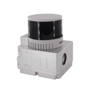
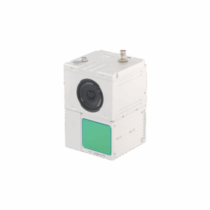
DJI Matrice 4 Series
1 productView full category →-
✓ Ready to ship3D Lidar, DJI Matrice 4 Series
GoSLAM X1 – Drone SLAM Scanner for Indoor and Confined Space Inspection
 3D Lidar, DJI Matrice 4 Series
GoSLAM X1 – Drone SLAM Scanner for Indoor and Confined Space Inspection
SLAM laser scanner in an anti-collision cage, plug & play on the DJI Matrice 4E and Matrice 4T, for 3D surveying of tunnels, tanks, underground spaces and confined spaces.
- 360° × 59° scanning field at 200,000 points per second
- Stated accuracy up to 1 cm, range up to 70 m
- No GPS required: positioning built by the SLAM algorithm
- Real-time colour point cloud, visible on the remote controller during flight
- Quick-mount anti-collision cage, 72 × 65 × 23 cm footprint
- Break-point resume with automatic alignment, unlimited resumes
- 128 GB TF card and integrated 5G module for remote viewing
- Post-processing software, 3D Gaussian reconstruction and viewer included
SKU: GS-X001-02